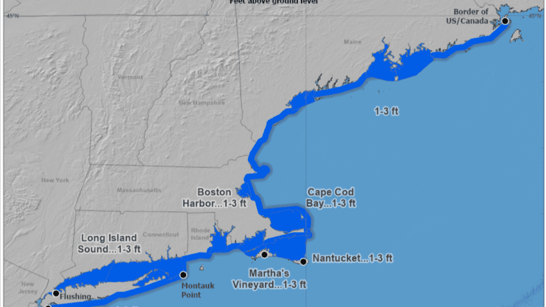
UNITED STATES: Satellites are closely monitoring Hurricane Lee’s progress as it churns above the Atlantic Ocean on a trajectory toward the Canadian coast, with a projected landfall on Saturday, September 16. Presently classified as a Category 1 hurricane, Lee boasts sustained winds of 80 mph (130 km/h).
According to both the National Oceanic and Atmospheric Administration (NOAA) and AccuWeather, the storm is anticipated to bring about power outages, storm surge flooding, and flash floods along the coastlines of Maine, New England, Brunswick, and Nova Scotia in the next 24 to 48 hours. Fortunately, as Lee approaches land, it is expected to weaken into a post-tropical storm.
It is a rare occurrence for hurricanes and their remnants to venture as far north as Canada. Yet, scientists assert that the ongoing effects of climate change are likely to render these destructive weather patterns more prevalent along the northeastern coast of North America.
Last year, Fiona, once a formidable Category 4 hurricane, reached the Atlantic coast of Canada as a post-tropical storm, inflicting widespread devastation.
In comparison, Lee is forecast to be somewhat less severe, according to the reports. At the time of landfall, the storm is projected to carry sustained winds of 30 mph (50 km/h), with gusts reaching up to 50 mph (80 km/h). In contrast, Fiona made landfall with sustained winds of 60 mph (100 km/h) and gusts up to 87 mph (140 km/h).
Aside from Lee, tropical storm Margot and tropical depression 15 linger over the Atlantic Ocean, with no anticipated threat to populated areas. While the Atlantic hurricane season officially peaked earlier in the week, the U.S. National Oceanic and Atmospheric Administration (NOAA) raised its intensity forecast from near-normal to above-normal levels in August.
This revision was prompted by the unexpectedly elevated surface water temperatures reported across the Atlantic Ocean throughout this year’s spring and summer seasons.
Also Read: Hurricane Lee Moves Closer to US and Canadian East Coast


