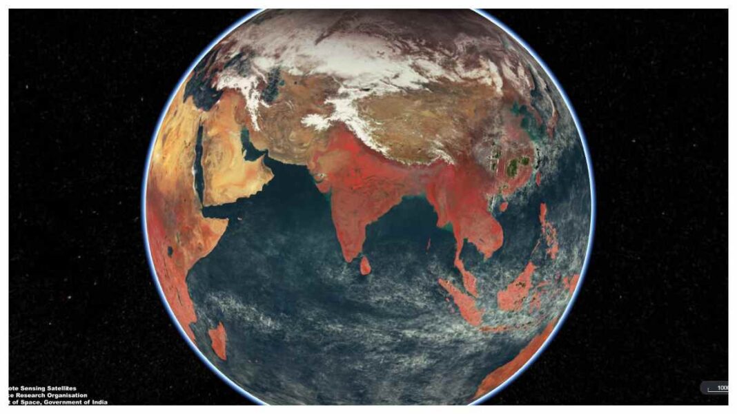
INDIA: The Indian Space Research Organisation (ISRO) has recently released a series of mesmerizing images of Earth captured by the OceanSat-3 satellite. These images offer a mosaic view of the planet, combining 2,939 images after processing 300 GB of data and showcasing every continent in high-resolution detail.
The OceanSat-3 satellite features three major instruments, including the Ocean Colour Monitor (OCM-3), which senses the Earth in 13 different wavelengths, providing information about global vegetation cover on land and ocean biota for global oceans.
This satellite also has other important features such as identifying potential fishing zones using chlorophyll, SST, wind speed, and land-based applications. The pictures have gone viral on the internet, and people around the world have expressed their admiration for the stunning view of our planet.
Some people have commented on the unique view of India from space, which has made them feel proud of their country. The pictures show how Earth’s ecosystems, resources, and potential are changing, and they show how far technology has come in space exploration.
It is fascinating to see how the different continents appear in separate colours due to variations in wavelengths, and these images have provided invaluable information about the planet, including global vegetation cover, and ocean biota.
Additionally, the satellite’s features, such as identifying potential fishing zones and observing wind speed, make it an essential tool for monitoring and managing Earth’s resources.
In conclusion, the OceanSat-3 satellite took pictures of Earth that show its beauty and diversity in a way that has never been seen before. These images offer valuable insights into our planet’s ecosystems, resources, and potential and are a testament to the remarkable technological advancements in space exploration.
The release of these stunning images by ISRO also highlights the importance of space technology in addressing global challenges, such as climate change, natural resource management, and disaster management.
Scientists and researchers can study Earth and its ecosystems from a unique angle thanks to space technology. This gives policymakers and decision-makers a lot of useful information.
The OceanSat-3 satellite is just one example of the many satellites and instruments that have been launched for Earth observation, highlighting the incredible potential of space technology for addressing global challenges and improving our understanding of the planet.
Also Read: ISRO to Launch 36 OneWeb Satellites Using Heaviest Launch Vehicle Mark-III from Sriharikota


